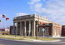
Greensboro Piedmont Triad International Airport (GSO)
Driving Directions / Travel by Car
(Greensboro, North Carolina - NC, USA)
Just west of downtown Greensboro, Piedmont Triad International Airport (GSO) is not far from the east-west I-40 interstate (Fordham Boulevard). In addition, the important US-68 highway provides access from the north and the south.
Other noteworthy roads close to Greensboro Airport include the Joseph M. Bryan Boulevard, which skirts the northwestern side of the grounds and becomes the Airport Parkway, in turn leading to the Triad Boulevard within the complex itself. West Market Street edges the southern border and links the US-68 with West Friendly Avenue.
Directions to Piedmont Triad International Airport (GSO) from the north of Greensboro:
- Take the US-68 highway south from points north
- Exit onto Airport Parkway for the terminal building and car park
Directions to Piedmont Triad International Airport (GSO) from the south of Greensboro:
- Take the US-68 north from all points south
- Turn right onto Airport Parkway for Piedmont Triad Airport
Directions to Piedmont Triad International Airport (GSO) from the east of Greensboro:
- Take the I-40 interstate west from points east and Greensboro
- Take Exit 210 onto the US-68 north
- After a few minutes, turn right onto Airport Parkway for the airport
- From the city, Joseph M Bryan Boulevard leads directly to the airport
Directions to Piedmont Triad International Airport (GSO) from the west of Greensboro:
- Take the I-40 interstate east towards Greensboro
- Exit the I-40 at Exit 210 onto US-68 north
- Turn right onto Airport Parkway for the terminal
Driving to the airport during rush hours from Greensboro may take longer than normal, due to excessive traffic when congestion along the I-40 interstate (Fordham Boulevard) can make the journey slow.
Greensboro Piedmont Triad International Airport (GSO): Virtual Google Maps
